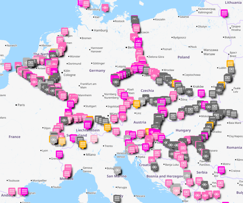
Where are the international railway lines in Europe?
That is not as easy to answer as it should be – so I set about making a map of all the cross border railway lines in Europe.
You can find the complete, zoomable map on uMap here.
The map is part for my own purposes, and has a more general use as well. Pink pins on the map indicate border lines I have been as part of the #CrossBorderRail project, yellow pins are places I have been sometime before, and grey are places I have not been.
The icons indicate the situation at each line – two train carriages and a track indicates there is a passenger service running regularly. A cross through the train carriages but not through the track indicates there is a legally active railway line, but no passenger service – that means there is either freight, or the track is simply maintained in an active state but without traffic. An icon only with a track with a cross on it indicates the cross border line is not in an operable state.
And then to the question: what to include?
The map shows every cross border line I can find, both current and former, between any European countries. For political reasons I have not included any borders to/from Russia or Belarus, but have included border lines to/from Moldova and Ukraine. Georgia, Armenia and Azerbaijan are Europe, but are not included as I cannot get to those without impossible transits or flying currently.
Any heavy rail lines, either 1435mm, 1520mm, 1600mm or 1668mm gauge, are listed the same way. Narrow gauge lines, and cross border tramways (i.e. not heavy rail) are listed, but in separate map layers.
Much of the data that went into the map is from European Commission, Directorate-General for Regional and Urban Policy, Sippel, L., Maarfield, S., Nolte, J., et al., Comprehensive analysis of the existing cross-border rail transport connections and missing links on the internal EU borders : annex 6 : expanded fact-sheets for each border section, Publications Office, 2018. However the more my work has advanced, so the map has grown to list a lot more borders than the European Commission did.
If you spot an error or omission, please let me know. And by all means use this map for whatever purposes you wish – it is licensed for re-use under the Attribution-NonCommercial-ShareAlike 4.0 International (CC BY-NC-SA 4.0) License – credit Trains for Europe, like the rest of this website.
